Here are a few of the tools used by the BRAILLE team on field campaigns:

When the KREX-2 Rover was being transformed into the CaveR rover, NIRVSS was an instrument which was updated to add needed features for the BRAILLE project. NIRVSS is an acronym for Near Infrared Volatile Spectrometer Subsystem. This instrument was created at NASA Ames Research Center, the BRAILLE team’s current home base. The instrument was originally developed to be used on the Resource Prospector, a rover expected to launch in 2020. The Resource Prospector rover will be headed to the moon, where it will use the NIRVSS to characterize the moon’s surface.
What is ATP?
ATP is an organic molecule used in organisms of all domains of life as a primary energy carrier and signaling molecule. Free energy released from ATP hydrolysis is used to drive unfavorable, nonspontaneous reactions. The use of ATP to drive these reactions allows cells to survive, develop, and reproduce. The need for and presence of ATP in all life on Earth makes it a good marker for estimating biomass.
Use of ATP Luminometer
BRAILLE will analyze cave surfaces with a hand-held ATP luminometer to survey the presence of adenosine triphosphate (ATP) and estimate microbial abundance. An ATP Luminometer estimates the ATP concentration of a sample by measuring the intensity of light released from a reaction between ATP and Luciferin/Luciferase reagents. The light intensity released from this reaction is dependent on the concentration of ATP. As ATP in a sample increases, more light will be increased and the luminometer will output a higher reading in relative light units (RLU). Sampling can be done by directly swabbing a surface with a surface sampling swab. The ATP collected by the swab can then be measured by an ATP luminometer or further purified to lyse ATP from cells before reading. I will be using the Hygiena EnSURE ATP luminometer and the Biocontrol Lightning MVP ATP luminometer (shown below).
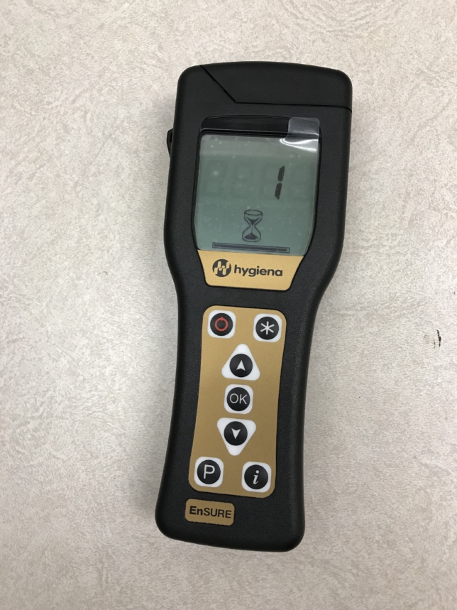
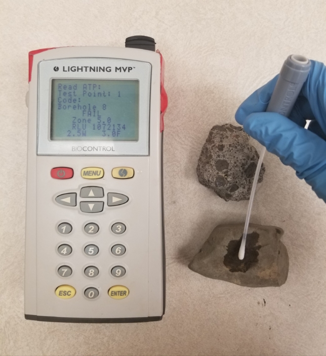
Application of ATP Luminometer during LABE Field Campaigns
ATP functions as an energy-carrying molecule and is used by all domains of life to support cellular metabolism. The amount of ATP present correlates directly with biomass. BRAILLE will examine gradients in the caves to look for variations in biomass as a function of light, humidity, temperature, human visitation, and color and textural variations on cave walls. Student researcher Daniel Milshteyn evaluations of ATP content on cave surfaces will be compared with the findings of the remote science operations team and other scientists to characterize biomarkers and assess the imaging and spectroscopic abilities of the rover to identify biomarkers.
xGDS (Exploration Ground Data Systems) is a highly collaborative, interactive suite of web software. It unifies data taken by scientific instruments (sensors, robots, ROVs, mobile devices, etc.) and observations of the science team into digital maps and displays for analysis, decision making, and easy collaboration. The xGDS team deploys a custom website for each project they work with that ties together a variety of apps that provide functions, like planning, monitoring, and analysis, depending on what is needed.
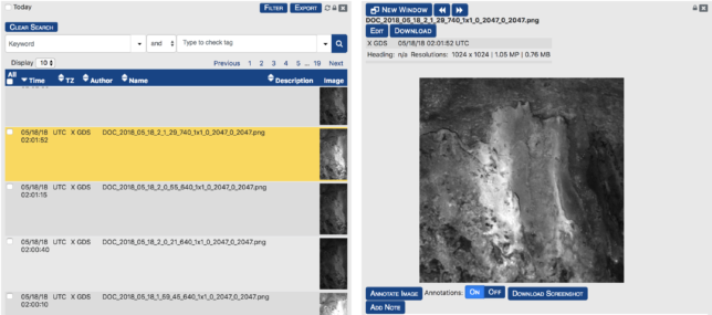
With xGDS, scientists can do real-time analysis of data and plan new data collection traverses while still on the field. Key features for BRAILLE include efficient collection, cataloging and building maps of data and observations along a traverse; traverse and data collection planning; realtime monitoring of assets including vehicle location and telemetry, and instrument data; geotagged note taking; centralized map content management and sharing; and planning of traverses with command options based on scientific instruments mounted to the CaveR rover. xGDS processes and maps all data taken by the scientific instruments mounted on our rover and maps them in real-time and supports live role-based geolocated note taking. These notes can be used to search for specific data.
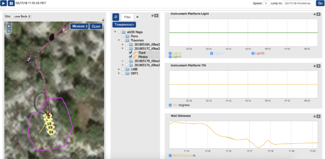
xGDS’s server infrastructure can run without access to the internet; this is crucial to a remote mission such as BRAILLE where communication is limited, unreliable, or unavailable. xGDS also supports archiving and review of all data, the ability to augment and edit field notes, search and export in JPEG, KML, or CSV formats for specialized analysis. The web tools are written in Python on Django and run on Linux infrastructure. The software is open source and published on GitHub.
