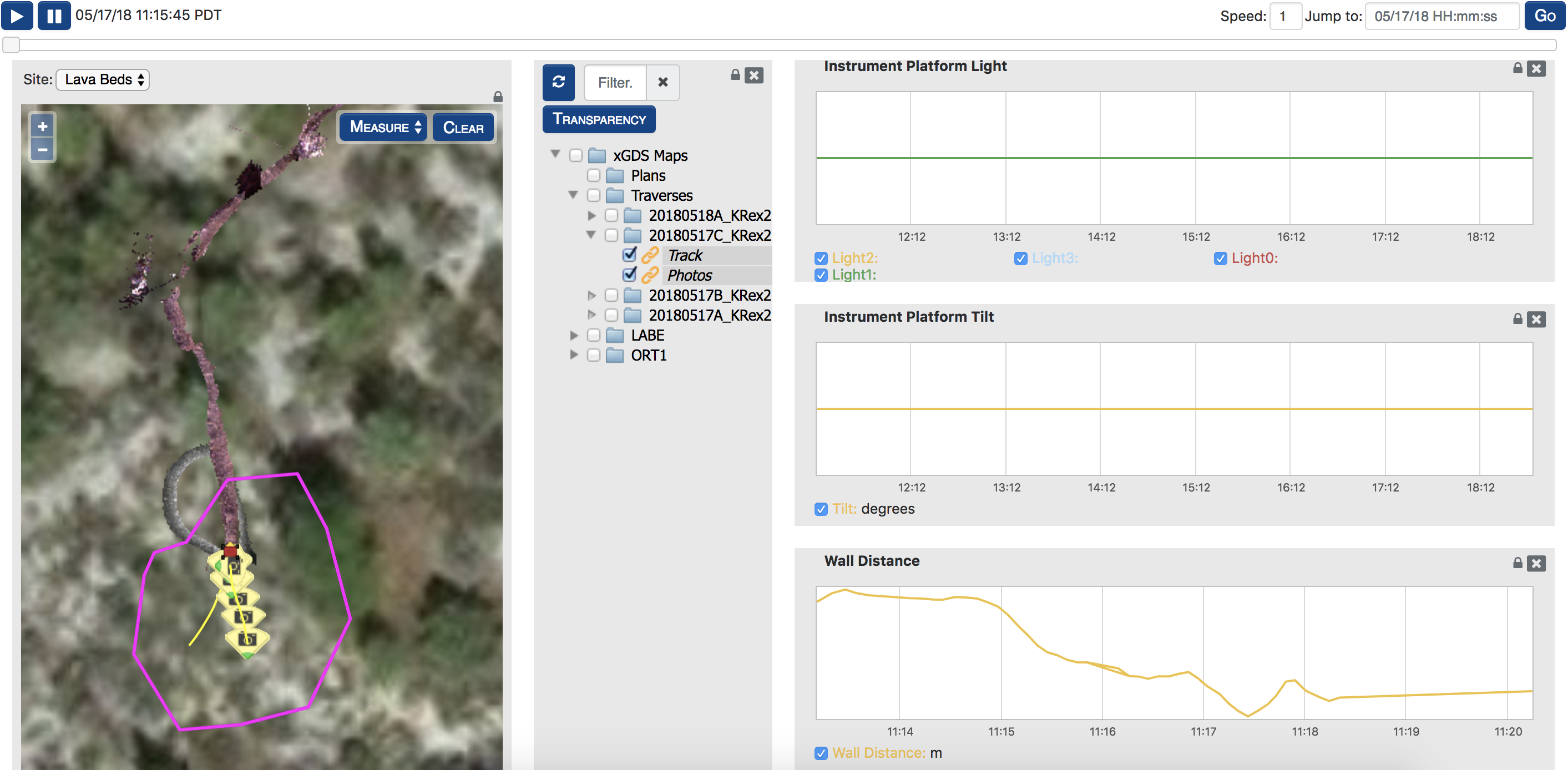
xGDS (Exploration Ground Data Systems) is a highly collaborative, interactive suite of web software. It unifies data taken by scientific instruments (sensors, robots, ROVs, mobile devices, etc.) and observations of the science team into digital maps and displays for analysis, decision making, and easy collaboration. The xGDS team deploys a custom website for each project they work with that ties together a variety of apps that provide functions, like planning, monitoring, and analysis, depending on what is needed.
With xGDS, scientists can do real-time analysis of data and plan new data collection traverses while still on the field. Key features for BRAILLE include efficient collection, cataloging and building maps of data and observations along a traverse; traverse and data collection planning; realtime monitoring of assets including vehicle location and telemetry, and instrument data; geotagged note taking; centralized map content management and sharing; and planning of traverses with command options based on scientific instruments mounted to the CaveR rover. xGDS processes and maps all data taken by the scientific instruments mounted on our rover and maps them in real-time and supports live role-based geolocated note taking. These notes can be used to search for specific data.
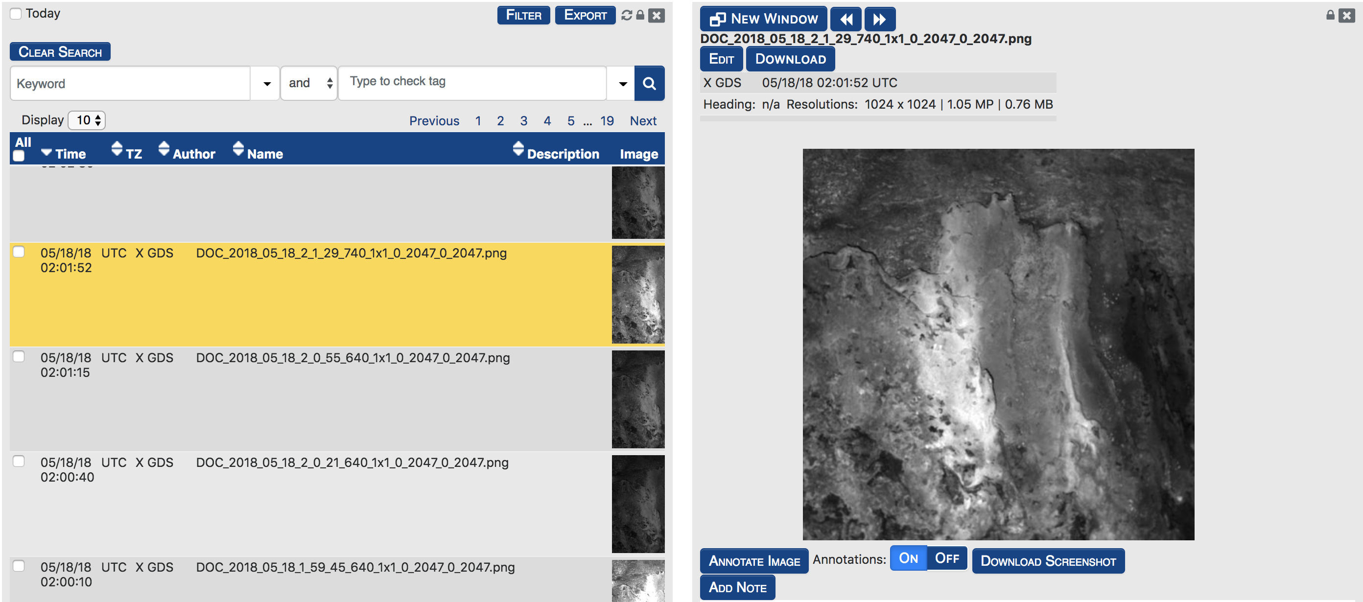
 xGDS’s server infrastructure can run without access to the internet; this is crucial to a remote mission such as BRAILLE where communication is limited, unreliable, or unavailable. xGDS also supports archiving and review of all data, the ability to augment and edit field notes, search and export in JPEG, KML, or CSV formats for specialized analysis. The web tools are written in Python on Django and run on Linux infrastructure. The software is open source and published on GitHub.